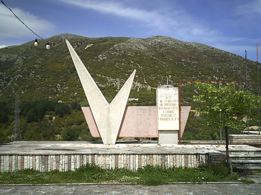
May 9, 2025: Despite the weather predictions, it did not rain
during the night. It was a pleasant night with the sound of crashing
waves drifting through camp.
The day's hike started immediately
heading uphill toward the town of Lukovë, and even early in the morning,
the temperature felt brutally hot. This wasn't even the hot season! I
couldn't imagine how bad the heat and humidity must be during the summer
months. The advice for this trail is to hike in the spring and autumn
since the winters are so cold and wet and the summers are so brutally
hot, and I could believe it. It felt brutally hot, even in May!
The
town of Lukovë supposedly had a market and restaurant, and Google even
reported that they were open! I would have to take their word for it,
however, since they were located a bit off trail and I missed the
turnoff and wasn’t inclined to go back to check it out. Anyhow, it still
felt a little early to take a break and Google also promised a couple
of other places that were open on the next beach I would be coming to. I
didn't really need anything in Lukovë and simply passed through the
town without any breaks.
 |
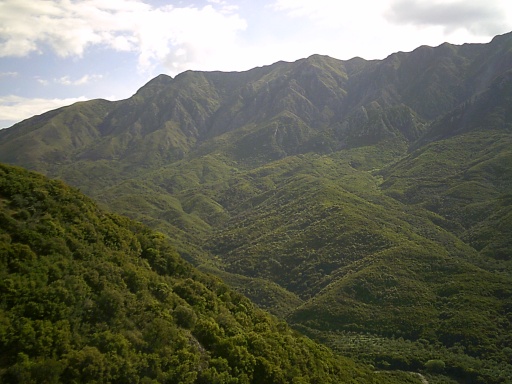
| The path through Lukovë was often narrow and steep! |
The
trail left town on a paved road, but fortunately it wasn't a
particularly busy road and soon I turned off it onto a more pleasant
gravel road. At one point, I reached a chain-link fence that was
blocking the road and wasn’t entirely sure what to do. It seemed clear
that I wasn’t supposed to continue forward, even though that was clearly
where the trail led. Even worse, there appeared to be absolutely no
alternatives around the closure.
However, nobody appeared to be
around and there seemed to be no good reason for the closure, so I went
around the fence and pushed onward.
It looked like they had used
heavy machinery to flatten a section near the top of a ridge, as if
preparing the land for a construction boom but, so far, nothing was
actually being constructed. Just a large, wide and flat area ready for a
resort. I had to scramble down a steep slope to get down to it as well,
which wasn't the easiest of tasks but I made it well enough.
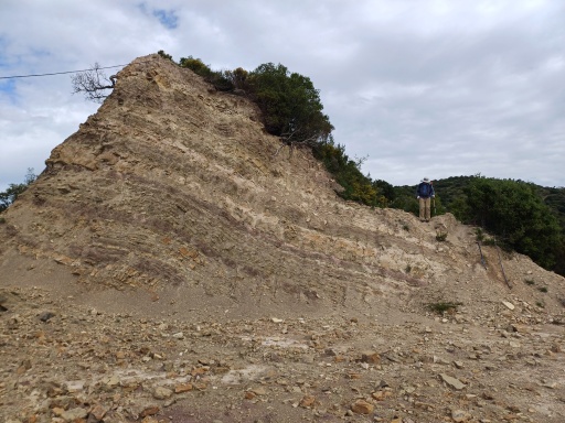 |
| See me, near the left side of the photo wondering how I was going to get down from there?! =) |
The
trail then left the gravel road entirely and followed what looked like
game trails the rest of the way downhill to the beach and, once again,
absolutely everything in town appeared to be closed or being
constructed.
And even though Google Maps promised two restaurants
and bars that were open, neither of them were. There were absolutely
zero services available for tourists. None. Zilch. Nada. Everything was
closed or under construction--absolutely everything. !I did find two
tourists from Germany loitering near their vehicle and they said that
they were waiting for a paddling session that was supposed to start 20
minutes earlier but the guides still hadn't shown up and they had no
idea if they would.I didn't have any suggestions about their problem,
but I asked if they happened to carry any extra water in their vehicle
that we could use since we were extremely low and there appeared to be
nowhere in town to buy any. They gave me two small bottles of water,
freebies from the hotel they had been staying at. It wasn't much, but I
was hugely appreciative of it. Even a little water was better than none!
I
walked around one of the closed restaurant-bars and sat down on some
beach chairs to take a break. Although the bar was obviously closed, I
spotted a large fridge with cold drinks inside with absolutely nobody
around guarding it. Could I grab something? Leave some money behind for
anything I took? It felt a little unethical, but a cold drink would have
really hit the spot! There were also some more water bottles that might
have been useful to add to my pack.
I didn't take anything right
then, thinking about if it was an ethical thing to do or not. I took a
break, reading my Kindle and relaxing.
At least I did for about 10
minutes until a few construction workers showed up and spoiled the
mood. They started speaking loudly to each other, put on some loud
music, then grabbed some hammers and started building a wooden walkway
from the beach-side bar out across the beach. Bang! Bang! Hammer!
Hammer!
 |
| Construction workers interrupted my otherwise peaceful break! =( |
They
were friendly enough when they saw me, waving hello then ignoring me
like I wasn't even there. That was fine by me, but all the noise was an
annoyance. After another 15 minutes or so, more of the workers arrived.
*sigh*
The German couple passed by soon as well, carrying
paddle boards toward the sea with a couple of guides and a couple of
other tourists. I guess their guides finally decided to show up, and I
waved as they passed by.
The peace and quiet was shattered and I was no longer enjoying the break.
Looking
ahead on my maps, I saw a creek at the edge of town and that was my
plan to restock with water. I had a filter. I even checked the satellite
view of Google Maps and the creek appeared to be a genuine creek with
water in it--not just a dry creekbed. No problem!
So I headed out,
passing by another restaurant and bar that looked like it had burned to
the ground. "According to Google, this place opened at 10:00am this
morning, I think they're wrong."
 |
| According to Google, this place opened at 10:00am, but I think they were incorrect! |
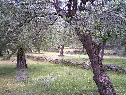
The
trail then led away from the sea, through some olive groves. After a
few minutes, four adorable little puppies came running out to me,
yipping and yapping. They didn't actually seem happy to see me, more
like warning me to stay away, but it was hard to take them seriously
because they were so small and cute. I wasn't going to bother picking up
any rocks to throw at them, but if they started getting too close or
aggressive, I could probably just kick them without too much trouble.
(Not that I wanted to kick puppies or anything, but I didn't really want
them biting me either!)
And while these puppies didn't seem
entirely friendly, they seemed to have enough sense that I was much
bigger and that they were no match for me, and kept their distance. No
kicking necessary!
The creek where I wanted to get water was to
the left, but it looked positively stagnant and disgusting. The
satellite images didn't make the water look so bad! There was livestock
all over the olive groves, though, and they clearly used the creek for
their own purposes. Now I kind of wished I had asked the construction
workers about buying some water, but I didn't want to backtrack either.
Another
five or ten minutes later, I found four adult angry dogs and those were
more concerning than the puppies. I picked up rocks when i spotted them
as they barked and ran toward me. "Back!" I shouted at them, swinging
my trekking poles around. "Stay back!"
Off to the left, I could
see the creek where I had wanted to pick up water, but that was
absolutely out of the question with the angry dogs clearly wanting to
rip my throat out. In my haste to get by the dogs, i missed a turn in
the trail completely and realized to my horror that the path up the
hillside that I needed to follow was back in the direction of the dogs.
Argh!
 |
| The trail out from the beach was super steep once i left the olive grove! |
With
pockets full of rocks, I got by them and followed the trail up an
incredibly steep, overgrown trail. I emptied my pockets of the rocks and
asked Karolina precisely how much water she had now that we had
bypassed the last potential water source until the end of the trail.
Between the two of us, we had about one liter of water, one! We wouldn't die out here, but we were going to be extremely thirsty and miserable until we reached town.
Anyhow,
the trail climbed steeply, probably about a thousand feet over the
course of a mile or so. The trail was badly overgrown with lots of
thorny brush that ripped at our clothes. Beads of sweat rolled down my
face like a creek. Good grief, it was hot! The only saving grace was
that clouds had blown in and obscured the sun so at least it wasn't
sunny, but it was still brutally hot and humid.
Karolina kept
asking how much higher we had to go, and I regularly updated her on our
progress. "Halfway up!" I told her. Then "3/4 up!" And finally we made
it--not to the top, precisely, but to where the trail largely flattened
out. Looking back, just a couple of kilometers, it felt like it had
taken us hours to complete. We drank some of our water, but nowhere near
enough. I could have easily guzzled every drop we had without any
trouble, but I knew that we had to ration it and reluctantly did so.
But
just because the trail flattened out, it did not mean the trail got
easier. Oh, no! The badly overgrown trail eventually just petered out
completely and I soon found myself having to bushwhack through some
seriously thorny brush to continue onward. Occasionally, I even spotted
a trail marker painted on a rock which was always
exciting--confirmation that I was still on the correct track even if
there was no trail to be seen.
 |
| So many wildflowers by the ruins! |
Along
this stretch, it did start to sprinkle a bit--annoying to be surrounded
by so much water but yet not enough to drink. At least if it was
pouring buckets I could catch some of it. The trace amounts of rain I
experienced was enough to get me wet and annoy me, but not enough to
catch and drink. Argh!
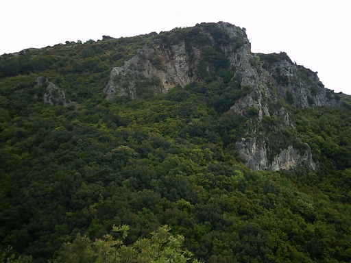
And then I spotted some ruins above the
trail, and the trail spilled out onto a gravel road. It was wide! It
was flat! Oh, praise the Lord! I was very excited about this and felt
that maybe my luck was finally turning.
The gravel road became a
bit overgrown in parts, but it was considerably faster and easier to
traverse than the terrain I had been doing. It followed the contours of
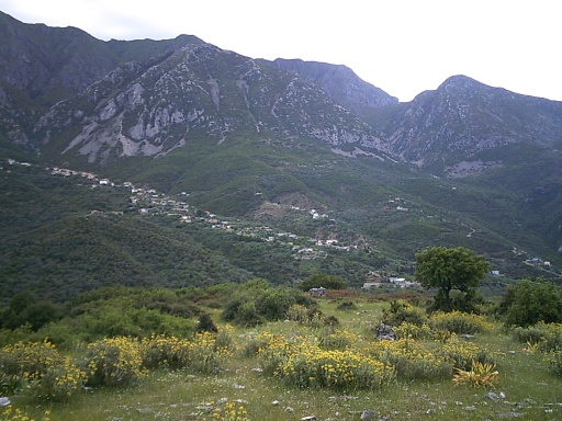
the hillside, and around a bend, I could see civilization That was Shën
Vasil, another small town about 1 kilometer before the town that I
actually wanted to reach. But I was getting close!
 |
| The town of Shën Vasil was in sight! |
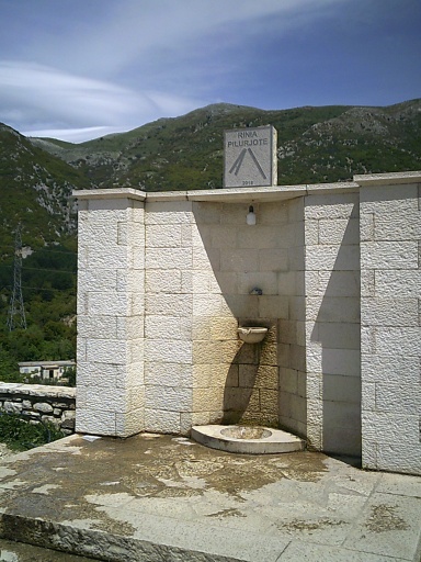
As
I approached even closer, I passed a spring along the trail that had a
water catchment around it. Yes! Water! Good, clean water! I filled up a
half-liter pouch and guzzled it down like a bear eating salmon. Then I
filled it up again and drank even more. Yes, wonderful water!
As I
approached closer to town, I came across two locals who spoke no
English but seemed to be asking me where I was headed, and I told them
Nivicë. They tried to talk to me more, but it was hopelessly muddled and
I had intended to continue straight on the road, but they pointed me
down a turn that seemed to follow a parallel road. The GPS tracks I had
for the trail didn't seem to follow either of the roads, but since I had
told them we were going to Nivicë and they were pointing us down that
way, I figured they must know what they were talking about and turned
down the parallel road.
That road eventually led me to a road towards town.
I
had pulled out my GPS and still saw that the end of the trail was
another kilometer away. This wasn't it. I then pulled out my phone with
the maps and had it locate me on my maps, and my suspicions were
confirmed--I had made it to... Shën Vasil.
Son of a bitch! I had gone the wrong way!
While i had no plans to finish the trail in Shën Vasil, it was marked
as an alternative route for starting or finishing the trail.
Google
Maps did show a market perhaps a five-minute walk away in town,
however, and I decided to walk to it and at least get a cold drink. I
deserved that much, so that's what I did.
There was no Coke in the
store so I bought a Pepsi instead. I also got a Fanta Exotic I was
perfectly happy to drink either of them. And on the spur of the moment, I
grabbed an Oreo ice-cream
After
finishing my drinks and ice cream sandwich, I walked the rest of the
way to the town square just to take a look around and followed the trail
back to where I had already been, having now walked in a big circle
around the one side of the town. This time, however, I turned uphill
away from the center of town and continued on my way to Nivicë.
The
rest of the hike was uneventful. I made it to Nivicë without any
additional trouble, and reached the end of the trail at a commanding
viewpoint overlooking most of the town. My plan was to take the bus from
there into the nearby town of Sarandë which was one of the bigger towns
along the coast and the main transportation hub for this section of the
coast. From there, I could catch a long-distance bus to Tirana (the
capital) and the airport where I had planned to fly out from.
 |
| The end of the trail.... |
According
to Google, there was a small store/restaurant near the main road out of
town, so I walked down to there to get another cold drink and figure
out how to get to Sarandë. The door of the restaurant had a closed sign
on it. *sigh* But then someone saw me and said to wait a second, and
they opened the door to let me in. Horray! I ordered a couple of drinks
and started figuring out how to get to Sarandë.
I had downloaded
an Uber-like app for hailing a taxi and it showed the price of a taxi
from there to Sarandë was about $25. No problem! So I hit the button to
do that, but it came back saying that there were no drivers available.
So that didn't work. I don't even know why I ever bother with
these apps. I've tried Uber a half dozen times over the years at various
trailheads and have always had the same problem. I've never managed to actually hail a taxi with an app when I really wanted one.
Well,
I could still take a bus, and I tried to find online if there was any
sort of schedule or routes about how often they came through, but I
wasn't having much luck.
What about hitchhiking? I've hitchhiked
all the time from trailheads due to lack of other options!" I was not,
however, sure about the legality of hitchhiking in Albania. I certainly
didn't want to end up in an Albanian prison.... So I started doing some
Internet sleuthing about the topic and as far as I could tell, it's not
only perfectly legal, but actually quite common in smaller towns with
little reliable public transit.
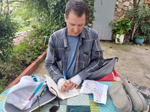 |
| I'm writing about the day's misadventures in my journal while I waited to get out of town. |
At
one point, I saw a bus go by in the direction that I wanted. Oh, shoot!
If they were running every hour, I would have at least an hour to wait
now. *sigh* If they ran less often than that, I might have a long wait!
While
I was doing this, the people running the restaurant said that they
could call me a taxi. Oh, yes! That would be great! They called some
place in Sarandë and the taxi driver told me the same $25 price, so I
agreed and he said it would take a bit less than a half hour to drive
out there to pick me up. No problem, I told him!
I then started
looking for lodging in Sarandë. I had made no reservations in advance
since I wasn’t entirely sure when I would finish the trail. I found a
reasonably priced place near the water and the beach.
I paid for
my drinks and packed up my stuff heading outside to wait for the taxi.
The taxi arrived about 10 minutes later, and I piled in and soon arrived
in Sarandë, a lovely town on the Mediterranean coast. =)
And thus ended my hike of the Southern Coastal Trail in Albania! And, of course, the route has been added to Walking 4 Fun as a premium trail for those who would like to try walking it virtually!
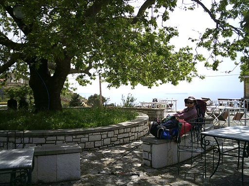
 |
| The view from my hotel in Sarandë was great! |
 |
| Waterfall near Lukovë |
 |
| Bird wandering around Lukovë |
 |
| Water! Beautiful water! |