July 24: I woke up and hit the trail at an early 6:00am. Already, the temperatures felt warm and uncomfortable which didn't bode particularly well for the rest of the day. There were a few pockets of thin forests during the first hour or so, but then the trail came out along gravel roads and endless plains emptiness. The terrain looked largely flat and bland, traditional Wyoming ranch lands as far as the eye could see.
And the trail would follow gravel roads almost the entire day. There was a real trail for the first mile or two, and another short section of a few miles that followed a paved highway, but the rest of the day was along gravel roads.
The paved highway, I thought, seemed like a colossal waste of money. The first 20 minutes along it, not a single vehicle passed me in either direction. It was a good, quality road that seemingly nobody ever used! After that, one vehicle about every 10 minutes would pass by. This was actually a good thing for me. Typically paved roads get a lot more traffic which is most definitely unpleasant, but I'd been on gravel roads that got more traffic than this one. It seemed a mystery to me why this road even existed.
All the same, I didn't like walking on the dark pavement. The road actually led all the way into Rawlins and many hikers take it as a shortcut into town. It's quite the shortcut too, cutting off a couple of dozen miles from the red-line route. It would be easy to lop off a day of hiking by taking the shortcut, so many hikers do. This section of trail is largely considered boring and useless anyhow. No reason to stretch it out any longer than necessary.
 |
| Do I dare follow the paved highway all the way into Rawlins...? No! I'm not doing it! You can't make me! |
Part of me understood this viewpoint, but I didn't entirely agree with it either. It was a harsh, shadeless environment, but it was also different and interesting to notice the adaptations the flora and fauna to this harsh environment. It seemed remarkable that anything could survive out here at all much less thrive. And the lack of tree cover might not have been as visually pretty as a thick, primordial forest, but the views out here are wide open.
And the terrain was generally pretty flat, so it was an easy section to cover. At least in that sense. I didn't find the change of scenery a disappointment, but rather just with different challenges and different types of hidden beauty.
The only good thing about the paved road into Rawlins, however, was that it was a shortcut. Which is great if you didn't appreciate this type of terrain, but I did. It was also still about a 20-mile hike into town and the idea of a 20-mile walk along a hot, paved road didn't appeal to me at all. Nope, I decided to stick with the red line.
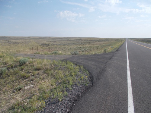 |
| I veered off the highway here, cursed to following gravel roads the rest of the day. Which was still an improvement over the paved road in my book! |
As the morning turned into afternoon, the temperatures continued to soar. It might not have been so bad if there was more shade available. Or even if the humidity wasn't so high, but it was definitely unpleasantly warm. Later in the afternoon, however, some cloud cover blew in which helped cool things a bit. It was still hot and humid, but the clouds made it a bit more bearable.
The change in scenery from the thick forests in the morning was rather dramatic. One Guthook comment suggested hugging a certain tree, half-joking that it was the last tree one would see for hundreds of miles. It's funny, but only because it was largely true.
Late in the afternoon, Reality Check caught up with me--which I thought was a fine trick since I had been absolutely 100% convinced that she had been ahead of me. How did that happen?!
Turns out, from the one paved road the trail had followed, she and Muddy had hitched a ride into Rawlins last night to enjoy the luxuries of civilization, then hitched a ride back to the trail this morning to continue the hike. Muddy had decided to walk the paved road the 20-or-so miles back into Rawlins, but Reality Check wanted to stick to the main red-line route and slackpack the 41 miles back into town. (Yes, 41 miles! She'd be hiking deep into the night by the time she finished.)
It was actually a brilliant idea, though. I could have hitchhiked into town, resupplied, and returned saving myself from carrying as much food out from Steamboat Springs. And getting an extra night to enjoy the town. The only potential problem is that the road wasn't very busy and who knows how long it would have taken to get a ride? It seemed to work out well enough for her and Muddy, though.
Muddy I would never meet, however, since he followed the paved road all the way back into town.
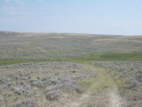 |
| A pretty typical Wyoming view |
The rest of the afternoon was uneventful. The trail followed gravel roads, along undulating hills through ranch lands filled with cattle. Except for a couple of ATVers who passed by, I had the roads all to myself. And the only hiker I saw all day was Reality Check, but she left me in the dust pretty quickly. She was, however, trying to cover 41 miles today. My goal was a more modest 25 miles or so, although I'd end up exceeding my goal by a couple of miles.
I pushed myself as far as Muddy Creek where I could camp near water and use all that I wanted for cooking dinner and cleaning the dishes. Muddy Creek actually wasn't very muddy, although Guthook comments warned that it would grow increasingly muddy as the trail followed it further downstream. Given the abundance of cattle in the area, I definitely treated the water but it looked pretty good even before treatment.
And thus ended another day in Wyoming....
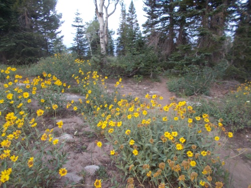 |
| Enjoy the trees this morning, because they would essentially be the last trees I'd see on the trail for hundreds and hundreds of miles! |
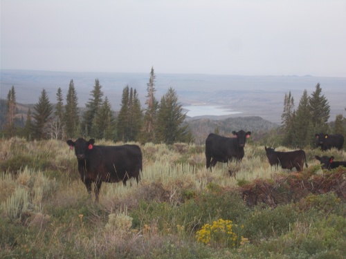 |
| Definitely getting into cattle ranching country! Look at those endless plains of flatness at the foot the mountain I'm currently on. That's where I'm headed! |
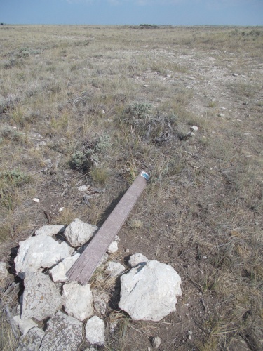 |
| Trail markers through this area weren't always in the best of shape. |
 |
| One of the few people I saw today were in this ATV driving by while I was taking a photo of the lupine. |
 |
| The black dot on the trail ahead of me is Reality Check, who was planning to hike 41 miles into town today. |
 |
| The clouds in the afternoon provided a bit of relief from the hot temperatures and oppressive humidity. |


1 comment:
Nice photos, Ryan!!
Post a Comment